|
||
|
| Physical
Address
(no physical address |
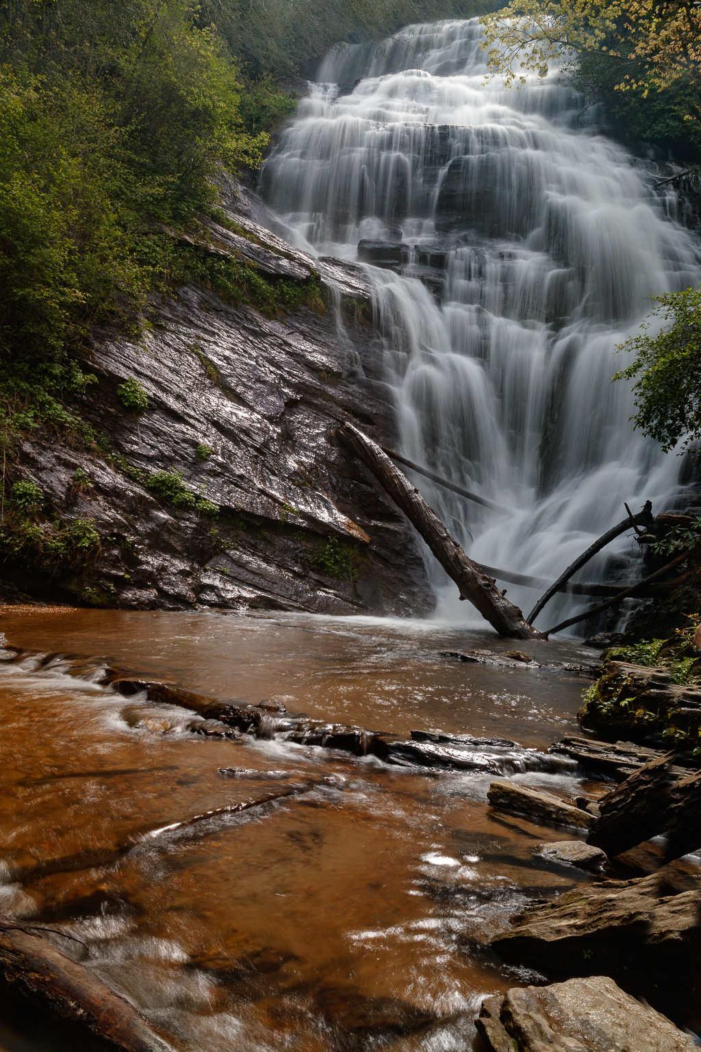
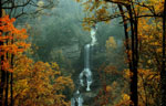
Photo Suggestions
|
|
Best time to shoot this falls in mid to late
afternoon |
|
|
This is not an easy falls to photograph, due
to the
location and where you can stand. |
|
|
If the water is down, you can hop across to a
sandbar and get a better shot of the falls |
Driving Tips and Other Information
|
|
From Walhalla, drive northwest on SC 28
for approximately 8 miles - Then bear right onto SC 107 - Drive 10.4 miles and turn left on Burrell's Ford Road (note, as on 4/18, there was no sign indicating the road, so check you odometer once you turn onto SC 107) - Drive approximately 3 miles to the Burrell's Ford Campground parking on the left |
|
|
Hike the Chattooga Trail (gravel) that
begins at the southern end of the parking lot. - Hike approximately 3/10 of mile to the Kiosk - Turn left at the Kiosk and the Kings Creek Trail is approx. 200 ft on the left (there is a sign designating the trail) - Follow the trail for approx. 1/2 mile to the falls - Approximately 250 yards in, you will need to cross over the bridge and turn left (east) onto the trail to the falls - There will be obstacles to cross over (a blown down BIG tree and large rocks. However, if you take your time, there should not be a problem. |
|
|
In the spring, look for abundance of
wild flowers |
|
|
While in the area,
consider going to Spoonauger Falls
|
|
|
Bathroom facilities are available in parking area |
Information compiled by Bob Spalding